land holders
Type of resources
Keywords
Publication year
Topics
-
The Exploring for the Future (EFTF) program is unmatched for the scale of geoscience data acquisition across northern Australia, covering 37 648 individual land parcels and 2.9 million km2. The scale of works has raised many new challenges for Geoscience Australia (GA) through the diverse range of field activities, and the numerous stakeholders from different social and cultural backgrounds, across multiple jurisdictions. Success of the program depended on the development and maintenance of a social licence to operate. This was broadly achieved for fieldwork activities through early engagement with stakeholders, including free, prior and informed consent. Here, we present two case studies of stakeholder engagement for facilitation of data collection: one focuses on broadscale, low-impact field activities associated with the AusAEM survey; and the other on Indigenous-focused engagement related to the Barkly Seismic Survey. Because of the complexity of project planning and managing such a large number of stakeholders, GA’s project governance team was expanded; it now includes a dedicated Land and Marine Access team and a commitment to adopt world-leading engagement practices. One practice is to consider impacts and benefits for all stakeholders—not just landholders—of field activities and data acquisition programs. This includes a plan for how the data are delivered back to the communities and stakeholders, and how information exchanges can be built into projects. The aim is for stakeholders to hold GA in the highest regard and understand the benefits to the Australian people, and ultimately their own communities, from the geoscientific data that GA produces. <b>Citation:</b> Mouthaan, R., Buchanan, S. and Sweeney, M, 2020. Land access and Indigenous engagement for Australian geoscience. In: Czarnota, K., Roach, I., Abbott, S., Haynes, M., Kositcin, N., Ray, A. and Slatter, E. (eds.) Exploring for the Future: Extended Abstracts, Geoscience Australia, Canberra, 1–4.
-
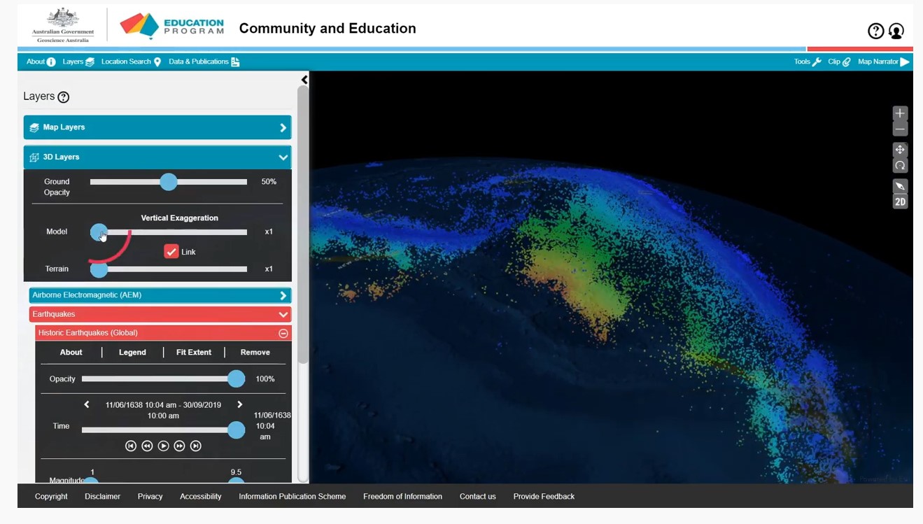
A series of short video clips illustrating how to use the Community and Education Data Portal (https://portal.ga.gov.au/persona/education). The Community and Education data portal is one of many data delivery portals available from Geoscience Australia, giving users access to a wealth of useful data and tools. It has been designed specifically for non-technical users, so that general community members, including educators, can access themed surface and subsurface datasets or images with enhanced capabilities including 3D visualisation, and online analysis tools. The User Guide Video complements the help menu in the portal. The User guide is broken into a series of topics 1. Introduction 2. Toolbar 3. Map layers 4. Multiple Layers 5. Background Layers and Sharing 6. 3D Layers 7. Tools 8. Custom Layers The step by step guides were produced by James Cropper.